| 20230803-Red_Rock_scenic_drive_flood_damage | Return to http://www.kcmeyer.com |
| page 1 of 4 |
8/2-3/2023
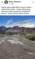
Late in the day/early evening the night before a significant monsoonal storm rolled through the western portion of the Las Vegas Valley. The National Weather Service issued a severe weather alert. I live in the northwest portion of the valley receiving a large amount of rain. I was also woken up the next morning to another storm before going to work. A friend of mine went to Red Rock for pretty sunset photos with the clouds only to be turned around due to the rain. While driving back he drove through a flash flood flowing across the main road, Highway 159, leading to the main entrance to Red Rock which deposited quite a bit of debris on the road. The core of Red Rock deep in the scenic drive was hit with a substantial amount of rain. By the next morning, Nevada DOT cleared the Hwy 159 access to Red Rock, but the scenic drive to Red Rock was closed until further noticed due to extensive flood debris on the road. Red Rock posted an alert on Facebook, but our company doesn't reference Facebook which is a bad business practice particularly after a significant weather event. Our company has a Facebook account for marketing purposes, but I tried to encourage creating one for the guides to be used for sharing information and to easily follow issues like this so the guides can be made aware quickly and efficiently. The idea hasn't gone anywhere. I imagine probably due to an HR issue. In any case, we had two open Jeep tours and two regular enclosed vehicle tours. The enclosed vehicles discovered the scenic drive was closed when they arrived so they informed the office who in turn told the open Jeep guides who turned around canceling the tour. The entire issue could have been resolving saving people money and time if we simply monitored Facebook.
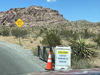
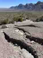
That night, the reports indicated the scenic drive would reopen the next day, but the time was unclear. We thus scheduled the tours accordingly. The next day, the guides went out there, both open Jeep and enclosed vehicle. Unfortunately, the scenic drive didn't reopen until 10:30 am. The delay was the use of heavy equipment to remove good-sized boulders and large amounts of gravel and debris from the road deep up the scenic drive closer to the limestone mountain cliffs. Warning signs were posted indicating there was gravel on the road. It was meant as a warning to not drive fast around the curves, particularly for motorcycles who like to take the corners hard. If they do, they WILL wipe out!
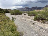
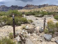
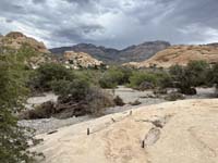
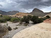
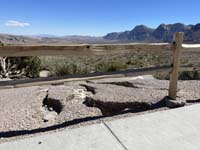
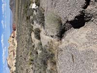
I had a tour in the afternoon so I was able to conduct the tour normally until the morning and previous day. I took a number of pictures noting the areas where water flowed across the road. I also admired the areas where flood waters had flowed down a wash impacting the road. The evidence of the flow was immense and much more so than I've ever seen in Red Rock. I have to say that if it rained a bit harder and/or longer, then there was the potential the flood could have completely taken out the road. If so, it would have taken months to rebuild. I have to say that Red Rock was lucky. I can tell the floodwaters were so intense flowing down the steep slopes that it went up and over the road. It would have been amazing to have been able to see this flood in action. Something to put in perspective, this type of water action is what originally sculpted this landscape to begin with.