| 20200112A-Old_Arrowhead_Trail-VOF | Return to http://www.kcmeyer.com |
| page 1 of 10 |
 |
 |
 |
 |
| 01-view_from_tra... | 02-Old_Arrowhead... | 04-trail_is_much... | 05-scenic_view_a... |
 |
 |
 |
 |
| 06-group_use_are... | 07-scenic_view_w... | 08-looking_back-... | 09-scenic_view_a... |
00-GoPro_of_hike.mp4 - [127 MB] - GoPro timelapse every 10 seconds. Best to view at 10-15% normal speed.
03-Old_Arrowhead_Trail_trailhead_area.mp4 - [64 MB]
Old_Arrowhead_Trail-VOF-20200112.gdb
Old_Arrowhead_Trail-VOF-20200112.gpx
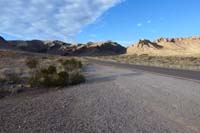
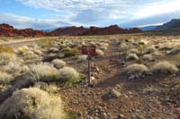
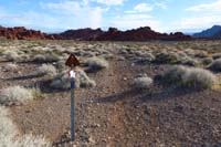
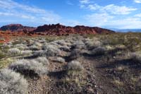
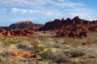
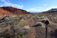
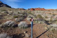
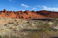
The Old Arrowhead Trail is a trail consisting of double track, single track, and ?? track trail. There are a lot of trail marker posts to help navigating the terrain. There is no way to hike this trail without those markers. There are several wash outs with some worse than others, but still navigable due to the trailer markers. Several maps indicate the road goes in one direction, but the trail marker posts indicate otherwise which is indicative of my track. The easist way to follow the trail is from west to east since predomently downhill. The first and last quarter of the hike were the most scenice. The other half in the middle I can do without due to the open desert and occasional trail finding issues.